Land | Building | Utilities | UAV | Mobile Mapping | Point Cloud Surveys | Rivers | Hydro | Construction
Land, Water & Engineering Surveying
Formed in 1986, Survey Operations has steadily grown into one of the UK’s leading survey companies. From surveying and mapping services to construction, utility scanning, laser scanning and UAV flight surveying, our company offers a full range of surveying services.
Primarily geared to the needs of design consultants and construction professionals, our experience and resources are also used by various technical and non-technical clients. Combining a full-time staff of over 80 surveyors, engineers, CAD and support personnel, our expertise, innovation and continuous investment in the most up-to-date equipment allows Survey Operations to provide a solution to any measurement request.
Click the links underneath to see some of the surveying services we provide


Latest Surveying Projects

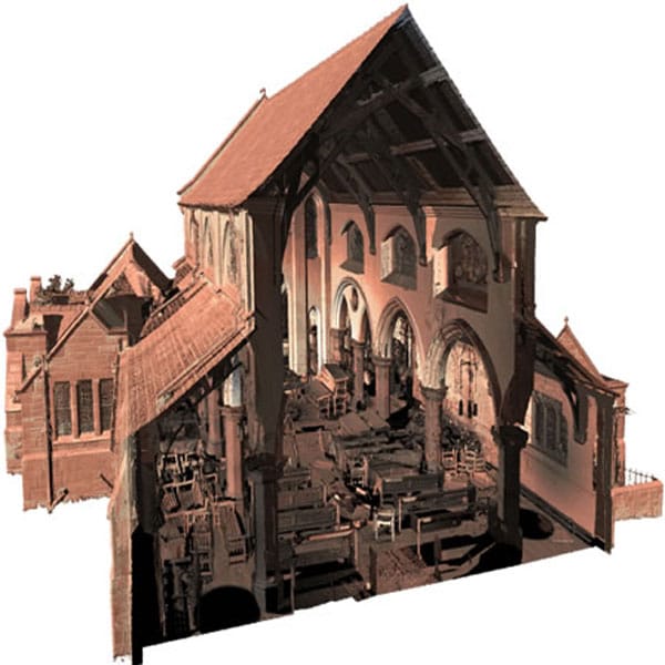
Sackville Street Measured Building Survey


Toddbrook Reservoir Dam Wall Monitoring
Surveying Team
We offer Topographical Surveys, Measured Building Surveys, Underground Utility Surveys (PAS128 Standards), 3D Laser Scanning, BIM & 3D Modelling (Revit Outputs), UAV Imagery, Mobile Mapping, Inland River Surveys, Inshore and Offshore Hydrographic/Bathymetric Surveys, Engineering Control & Monitoring Surveys and CCTV Drain Surveys.
Our main offices are located in Skelmersdale, West Lancashire, some 5 miles from Junction 26 of the M6 motorway and approximately 1 mile from either Junction 3 or Junction 4 of the M58.
Contact one of our team members here, or message us on our contact page.
Our Latest Surveying News
Read about our latest work and the interesting locations we get to visit when surveying, as well as the latest updates in our industry, all written in our blog.